Wild Life

Feel the wondering variety of wild life and bio diversity in this little island

Surfing

Arugam Bay in east cost of Sri lanka is the one of best places in earth for surfing.

White Water Rafting

The small town of Kitulgala in the hill country is the most famous whitewater rafting location in Sri Lanka.

Goldi Sand Beaches

Experience the Miracle Beaches

Cultural Events

Kendy Perahara

Showing posts with label Hiking. Show all posts

Friday, July 13, 2012

Diyawanna Oya walking track & Street Paintings

The Diyawanna Oya walking track, an area for jogging and exercising was declared officially opened for the use of the public by Chamal Rajapaksa, Speaker of the Parliament.
The programme was initiated under the Colombo City Development project with the support of the Ministry of Defence and Urban Development Authority.

The large parking lot adjacent to Diyawnna Oya made it easy to access this beautiful, free spectacle. Along the length of the promenade, people were spoilt for choice when it came time for a breather, with ample number of benches facing the rippling stream. And yet, some preferred to lie in the cool grass or laze on the large stone stairwell that led down to the water's edge.
As dusk fell canoes took to the water to merge with the sunset silhouettes. The constant breeze kept those sail boats speckling the river conjuring images of a Venetian postcard and everywhere I looked was a blend of the elements graced with a vibe of placidity... a truly amazing symphony of the environment.
In poetic praises, also referred to as sandesa kavi of the 15th Century AD, relayed stories that commended booming agriculture, towns and their economies, especially of those thriving in and around the Diyawanna Oya, of the Kotte Kingdom. The poets were usually monks from the Kingdom's many temples and their kavi or poetic messages were sent to the kings via birds. It is said that the Kotte Kingdom, among many other reasons, was praised as such as it was blessed with the protection and viable advantages of the Oya. Even today, that much is true.
One could call this the green zone, it was lush with greenery for one thing, and it was amidst a bustling town. People needed this, it was a quintessential setting, and folks came here for refreshment, to simplify the challenges of the mundane. The nurturing combination of the water, the walkway, the trees, the grass and the pedestrian crossing takes you from busy to benevolent.

Recent developments have made the area around this part of the Oya what it is now with the river's perimeter cleared of brush and widened for quite a breathtaking view of the water. The space, symbolically welcomes the discerning.
You could say that life is good for the city-dwellers as they can actually have a balance of both worlds. Just as one would head-off to the nearest ocean getaway at Galle Face Green, Diyawanna Oya could be the destination for a stroll by the riverside or even a river-boat ride. The Oya was fast gaining popularity no doubt.
Kotte, although the capital city of Sri Lanka, was lesser known for its ‘fun' aspect than that of its commercial counterpart, Colombo. However, for a city seriously bound to its official surroundings, such as the Parliament building amongst others, this new laidback space around Diyawanna Oya is what turns the tables.
It was easy to forget the extremely busy main road that ran right beside the streamlined rampart or school or even the office hours that hung on the brink of a fast-ending weekend.


Source - Click here


Monday, July 2, 2012

Small Sripada (Little Adam's Peak) - Ella

The mountain range in the Badulla, Ella area which is considered for Small Sripada (Little Adam's Peak) has become an attraction to local and foreign tourist. A large number of people visit the area to admire its scenic beauty. Small Sripada is located about 2 km from the Ella town. From this location Kataragama and the Hambantota beach which are hundreds of kilometers away can also be seen. The Namunukula, Poonagala and Narangala mountain ranges also located on near this place. The mount extent about 10 acres some of the Small Sripada is full of biodiversity.


Scenic Ella Gap

 Ella Rock from Little Adams Peak


Ella - Wellawaya road from Little Adams Peak

 overlooking Ella gap and mountain ranges from Ella rock

The view from Little Adam's peak. Ella Rock and the Ella Gap can be seen.

Thursday, May 24, 2012

Hanthana Mountain Range


The Hanthana Mountain Range lies in central Sri Lanka, south-west of the city of Kandy. It was declared as an environmental protection area in February 2010 under the National Environment Act. The maximus height of the range is 3800 ft. The mountain range consists of seven peaks. The highest one being the Uura Kanda. The range is a favourite destination among the mountain hikers in Sri Lanka. University of Peradeniya is situated adjacent to the Hanthana mountain range.

Source - Click here


Monday, March 5, 2012

Ambuluwawa Bio Diversity Complex, Gampola.

 
The Ambuluwawa biodiversity complex is a unique combination of nature and human creation. The 327-acre complex in Gampola, few kilometers away from Kandy is considered the fourth botanical garden in the country. Manmade constructions there include an international level conference hall, an agrarian training centre and a Buddhist worship area, including a Stupa 157-foot tall. From Ambuluwawa biodiversity complex, one could have a panoramic view of Sri Pada, Piduruthalagala, Namunukula, Bathalegala, Alagalla, Hantana and Knuckles and several other mountains.
  Ambuluwawa Tower -View from Gampola Town
 When the planets and stars disappear trom the sky and when the nectar appears in or drops from flowers on tree tops and when the sun spreads its rays as it rises over the mountain of the east, you may set off trom Ambuluwakada happily.

Ambuluwawa – Biodiversity

Biodiversity at Ambuluwawa has a more complexed expansion than that of the common examples of biodiversity. Ambuluwawa is a rock mountain but it is different trom rock mountains commonly seen in Sri Lanka . It is made of special type of rock known as "Inselberg" and is least subject to erosion caused by natural forces.
Experiments on the diversity of vegetation at Ambuluwawa are still in progress. According to the research work so far done, there are about 200 varieties of plants belonging to 80 plant families. The soil here is red or brown and belongs to the latezoic type. Medicinal plants known as 'iramusu ', ' muva kiriya ' and ' nawa handi ' are the common plants grown in the area.

Surrounding the mountain there are uniformly spread ever green forests, groves of blossomed flower plants and creepers which make the breeze around the mountain cool. Panoramic view of the mountain ranges is enticing and impressive. Clearly visible mountains such as Pidurutalagala in the east, Bathalegala or Bible Rock in the west, Sri Pada or Adams Peak in the south and Knackles range in the north enrich the scenic beauty of the place. Apart from these, mountain ranges associated with Alagalla and Kadugannawa, mountains like Hanthana and Hunnasgiri and mountains in Nuwara Eliya district are also clearly visible and they add beauty to the surroundings.

There is no other summit than Ambuluwawa which is surrounded by a large number of mountain ranges of scenic beauty in Sri Lanka . The precious water of the Mahaweli the life blood of up country people and the long tracts of paddy fields fed by Mahaweli water make the

Ambuluwawa rock more attractive. Thousands of rival, houses and the crowded streets of Gampola town can be seen at a single place - Ambuluwawa and the view is unique and impressive.

Modern Vision

Modern development of Ambuluwawa has converted it to a reserve for folk museum based on a clear cut vision. Three tanks built on the Summit provide water down to the bottom of the mountain. Stones being an essential element of the environment the Stone Park which displays a collection of stones is a new experience. Local and foreign scholars who wish to conduct research can have necessary facilities here in a calm and quiet atmosphere. The Bo sapling obtained from the Sri Maha Bodhi grows upon the summit offering a sense of tranquility to everybody.

Beautiful entrance, twin ponds, water parks and stone parks are unique features of the Ambuluwawa summit. Herb gardens and nature bring immense relaxation both to mind and body. Spine plantations and orchards are fine examples which tell us that local agro economy should be developed. International Conference Hall is equipped with all the necessary facilities for conferences. Area above the tank is a forest haunted by deers and sambhars making the environment lively. Roads with sleeps and precipices give you frightening experience. The sub-way below the summit gives you excitement. A restaurant is run in an enchanting location. "Govi Sevana" has been established for the farmers to congregate. An image house of the latest style is being constructed to place the Buddha statue made of stone. The observation room on the top of the mountain provides facilities to admire the superb panorama. An inscription has been installed explaining the objective of the biodiversity complex. Hon. D.M. Jayaratne, Prime Minister creating this wonderful biodiversity complex with relentless pursuit.


View Larger Map

Thursday, January 26, 2012

Lipton's Seat


Located in  Haputale 173 KM (107 Miles) From Colombo in the Badulla District, and is 4695 ft high above the sea level. It is one of the places with a very rich biodiversity and allows a very beautiful view of the Southern Plains. It is approximately 193 km away from Colombo. The town is no doubt one of the spectacular places in Sri Lanka. Haputale is makes hiking and trekking a great exhilarating exercise. The major attraction of Haputale is the Liptons seat, Adisham Bungalow and the famous Dambatenna tea factory.


Near the Dambatenne tea factory, the Lipton’s Seat lookout rivals the views from World’s End (and it’s free). The Scottish tea baron Sir Thomas Lipton used to survey his burgeoning empire from here.

Take the signed narrow paved road from the tea factory and climb about 7km through lush tea plantations to the lookout. From the tea factory the ascent should take about 2½ hours. The earliest bus leaves Haputale at 6.30am. Look forward to the company of Tamil tea pickers going off to work as you walk uphill to Lipton’s Seat.


View Larger Map

Monday, January 23, 2012

Knuckles Mountain Range


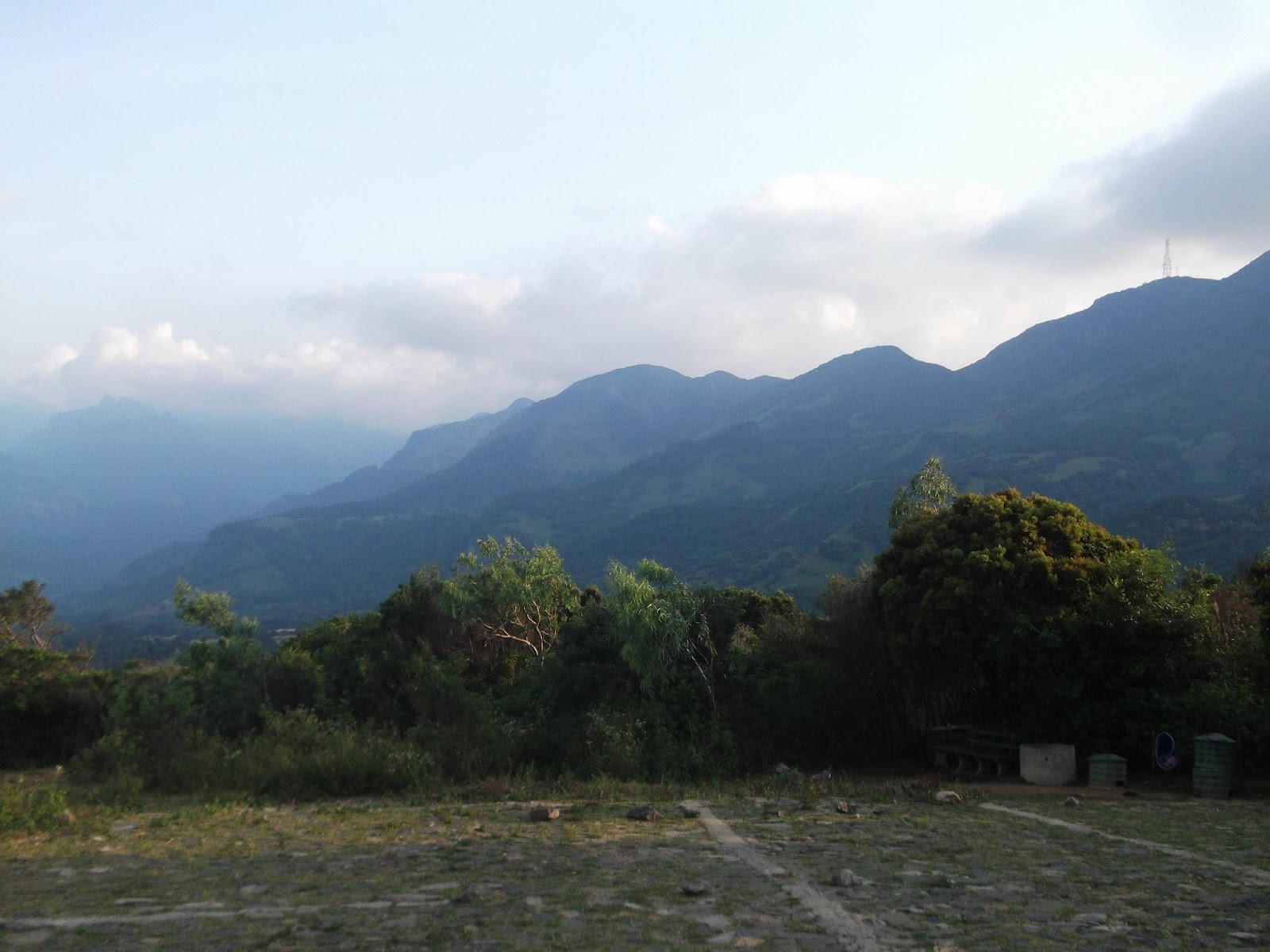
The Knuckles Mountain Range lies in central Sri Lanka, north-east of the city of Kandy. The range takes its name from a series of recumbent folds and peaks in the west of the massif which resemble the knuckles of clenched fist when viewed from certain locations in the Kandy District.

Whilst this name was assigned by early British surveyors, the Sinhalese residents have traditionally referred to the area as Dumbara Kanduvetiya meaning mist-laden mountain range (Cooray, 1984). The entire area is characterised by its striking landscapes often robed in thick layers of cloud but in addition to its aesthetic value the range is of great scientific interest. It is a climatic microcosm of the rest of Sri Lanka. The conditions of all the climatic zones in the country are exhibited in the massif. At higher elevations there is a series of isolated cloud forests, harbouring a variety of flora and fauna, some of which cannot be found anywhere else in the world. Although the range constitutes approximately 0.03% of the island’s total area it is home to a significantly higher proportion of the country’s biodiversity.


One of the hill top of Knuckles, located in Matale district, 142 kilometers from Colombo. The middle of Rattota – Pallegama road. The path from Rattota, consists of 14 bends up to Riverstan. It is one of several hill tops in the Knuckles range being located in a windy gap on a range of scenic mountains with frequently changing climate; Riverstan was highly popular with foreign & local travelers. Two telecommunication towers were setup on the both summits of the Riverstan Mountain. The access road for them was a private one and no vehicles were allowed beyond the Riverstan gap. The climate was changed in every minute, Sometimes it brought little sun rays, and sometime cool wind, but most of the time with a thick mist & the wind was blowing briskly, really that was an amazing. The forest was consisted with pigmy trees. “Maha rewla” (Old man’s beard) and many orchids were driven out their loneliness. The mist was gained them a fresh & wet look for ever. It was an eye-catching view of Pitawala pathana & paddy fields of lonely villages in the Knuckles range. Since the surrounding was covered with a shawl of mist, there is a tiny waterfall in Bamarakiriella village close to Riverstan.


Photo Source - Click here


View Larger Map

Sunday, January 22, 2012

Horton plain Sri Lanka

The Horton Plains are located on Sri Lanka 's highest plateau, between altitudes of 2,000 and 2, 300m. The landscape typically consists of undulating lands covered in a tropical cloud of forests or verdant montane savannah grasslands, locally known as patannahs. Visiting Horton Plains or 'Mahaeliya' as it is traditionally named is quite popular amongst locals, who mostly come to admire the views from the park's thrilling escarpments such as World's End at weekends . For this reason we recommend that you try to organise your visit during a weekday as this ensures that you will experience the Plain's isolated serenity.
Visitors to the park can follow a 10km loop that incorporates all of the spectacular features, enabling them to enjoy them while adhering to the strict rules for environment protection and nature conservation. The best time to visit is early in the morning as this is when the air is likely to be clearest so that you can enjoy the best of the views. In the afternoons, clouds tend to descend and the area becomes submerged in mist. This is equally enthralling though and provides evidence for the evolution of this forest type. Allowing a half-day should give you plenty of time to enjoy it all at a leisurely pace. 

 
The Plains are actually named after Sir Robert Wilmot Horton, a rather selfish and bloody-minded Brit (no surprise there then) who was singularly responsible for the slaying of all of the elephants in the area between 1831 to 1837. Although there is little hope of elephants ever returning, you can at least walk around in comparative safety admiring the many other interesting creatures around and about. Of these perhaps the most worthy of a mention are the Samber Deer, a common sight at dusk and in the early hours of the morning.
In order to get the most out of your visit we recommend that an expert naturalist provided by Eco-team take you around. These guides are good company and extremely knowledgeable; having their input can add a lot more interest to the trip.


Source - Click Here


View Larger Map

Related Posts Plugin for WordPress, Blogger...

 
Google Analytics Alternative