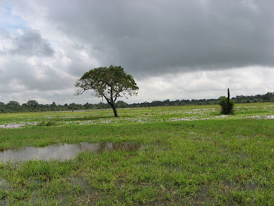
Wild Life

Feel the wondering variety of wild life and bio diversity in this little island

Surfing

Arugam Bay in east cost of Sri lanka is the one of best places in earth for surfing.

White Water Rafting

The small town of Kitulgala in the hill country is the most famous whitewater rafting location in Sri Lanka.

Goldi Sand Beaches

Experience the Miracle Beaches

Cultural Events

Kendy Perahara

Friday, May 25, 2012

Poson Festival in Sri Lanka


Mihintale - Anuradhapura


 Poson Thorana


Poson full-moon poya day (Poson Poya Day/Poson Festival) is celebrated the arrival of Buddhism in Sri Lanka in the 3rd century BC, a festival of great historical and religious significance celebrated island-wide by Buddhists. Poson, held on the full moon day of June, commemorates the occasion over 2,000 years ago when Arahat Mahinda, son of Emperor Asoka of India, converted King Devanampiyatissa to Buddhism. The main center of celebration is Mihintale, the ancient monastic complex where the royal missionary monk Mahinda perched the first sermon to the ruling king and at Anuradhapura the ancient capital, to which large crowd of pilgrims converge. Mass religious observances, illuminations pageants are part of the celebrations.

For Buddhists, this hallowed day of Poson is second only to Vesak in terms of importance. Although Poson is celebrated throughout the island, the major ceremonies are to be found in Anuradhapura and Mihintale. Long lines of devotees dressed in white climb the many steps to the top of the Mihintale hill first to the temple, and then to the dagobas that lie adorn the nearby hillocks. In addition, many devotees climb to the very top of the rock, to the spot where Arahat Mahinda delivered his initial discourses.

Poson Poya is celebrated annually with great fervour throughout the island but particularly in Mihinthalaya where Mahinda Thero first put his foot to preach the word of Lord Buddha.This is why Mihinthalaya is called the cradle of Buddhism in Sri Lanka. With the establishment of Bhikku Sasanaya all other elements of a civilized society began to emerge with the art of writing,art, architecture, river civilization, religious rituals in song and dance forms, literature, all with royal patronage. 

Also in the Sithul Pawwa Raja Maha Viharaya in the edge of the Hambantota district celebrated annually with great fervour, the poson festival.

Many religious activities are organized during this poson period in Sri Lanka such as Sil campaigns, Bodhi Poojas, Dansalas (Freely giving foods, coffee, tea from people ), Poson devotional songs, Poson pandols ( thoran) and lanterns. Lot of Poson pandols and Poson Lanterns are making Anuradhapura in Sri Lanka.

In Poson many temples are filled with Atasil devotees and pilgrims all over Sri Lanka to mark this great event. The devout, clad in pure white with no make-up or jewelry,make their way to the temple,to spend the next twenty four hours in quiet contemplation. While the rest of the village, gather at the temple grounds after sunset to participate in lesser religious activities, like reading of holy books, or listen to the saffron clad monk relate ancient stories from Lord Buddha's previous lives. During the Poson Festival, the selling of alcohol and flesh is usually prohibited, with abattoirs also being closed.

A festival of great piety and sanctity which focuses on the virtual of compassion to all living creature,it is also one of much colour and gaiety, with street, homes and public places decorated with beautiful and finely decorated hand-made paper lanterns small and big and glittering with illuminations, pandals depicting the different occurrences in the life of the Buddha or his previous births. 

Source - Click here

Thursday, May 24, 2012

Hanthana Mountain Range


The Hanthana Mountain Range lies in central Sri Lanka, south-west of the city of Kandy. It was declared as an environmental protection area in February 2010 under the National Environment Act. The maximus height of the range is 3800 ft. The mountain range consists of seven peaks. The highest one being the Uura Kanda. The range is a favourite destination among the mountain hikers in Sri Lanka. University of Peradeniya is situated adjacent to the Hanthana mountain range.

Source - Click here


Wednesday, May 23, 2012

Udawalawe National Park


Udawalawe National Park lies on the boundary of Sabaragamuwa and Uva Provinces, in Sri Lanka. The national park was created to provide a sanctuary for wild animals displaced by the construction of the Udawalawe reservoir on the Walawe River, as well as to protect the catchment of the reservoir. The reserve covers 30,821 hectares (119.00 sq mi) of land area and was established on 30 June 1972. Before the designation of the national park, the area was used for shifting cultivation (chena farming). The farmers were gradually removed once the national park was declared. The park is 165 kilometres (103 mi) from Colombo. Udawalawe is an important habitat for water birds and Sri Lankan Elephants. It is a popular tourist destination and the third most visited park in the country.


Physical features

Udawalawe lies on the boundary of Sri Lanka's wet and dry zones. Plains dominate the topography, though there are also some mountainous areas. The Kalthota Range and Diyawini Falls are in the north of the park and the outcrops of Bambaragala and Reminikotha lie within it. The park has an annual rainfall of 1,500 millimetres (59 in), most of which falls during the months of October to January and March to May. The average annual temperature is about 27–28 °C (81–82 °F), while relative humidity varies from 70% to 82%. Well-drained reddish-brown soil is the predominant soil type, with poorly drained low humic grey soils found in the valley bottoms. Mainly alluvial soils form the beds of the watercourses.

Ecology

The habitat surrounding the reservoir includes marshes, the Walawe river and its tributaries, forests and grasslands. Dead tree standing in the reservoir are visual reminders of the extent of forest cover before dam construction. Green algae, including Pediastrum and Scenedesmus spp., and blue green algae species such as Microsystis, occur in the reservoir. Areas of open grassland are abundant as a result of former chena farming practices. There is a plantation of teak beyond the southern boundary, below the dam, which was planted before the declaration of the park. Species recorded from the park include 94 plants, 21 fish, 12 amphibians, 33 reptiles, 184 birds (33 of which are migratory), and 43 mammals. Additionally 135 species of butterflies are among the invertebrates found in Udawalawe.

Flora

Hopea cordifolia, Memecylon petiolatum, Erythroxylon zeylanicum, and Jasminum angustifolium are endemic floral species recorded from the park. Hopea cordifolia is found along the river along with Terminalia arjunaPanicum maximum and Imperata cylindrica are important food sources for the elephants. Chloroxylon swietenia, Berrya cordifolia, Diospyros ebenum, Adina cordifolia, Vitex pinnata, Schleichera oleosa, and Diospyros ovalifolia are the common taller trees. Terminalia bellirica and Phyllanthus emblica are plants of medicinal value found in the forest. Cymbopogon confertiflorus grass species and Grewia tiliifolia bushes are common in the grasslands.

Source -  Click here

Sunday, May 20, 2012

Wasgamuwa National Park


Wasgamuwa National Park is a natural park in Sri Lanka situated in the Matale and Polonnaruwa Districts . It was declared to protect and to make a refuge for the displaced wild animals during the Mahaweli Development Project in 1984 and is one of the four National Parks designated under the Project. Originally it was designated as a nature reserve in 1938, and then in the early 1970's the area was regraded as a strict nature reserve. Wasgamuwa is one of protected areas where Sri Lankan Elephants can be seen in large herds. It is also one of the Important Bird Areas in Sri Lanka. The name of the Wasgamuwa has derived through the words "Walas Gamuwa". "Walasa" is Sinhala for Sloth bear and "Gamuwa" means a wood. The park is situated 225 km away from Colombo.

Elephant at Wasgamuwa

Leopard at Wasgamuwa


Physical features

The National Park's annual daily temperature is 28 °C (82 °F) and has a dry zone climate. Annual rainfall ranges between 1650-2100 mm. Rain is received during the north-eastern monsoon, from October to January. July-September is the dry season. Highest elevation of the National Park is Sudu Kanda (White mountain), which is 470 metres (1,540 ft) of height. The soil of the national park contains quartz and marble. The forests of Wasgamuwa represent Sri Lanka dry-zone dry evergreen forests. The park consists of primary, secondary, riverine forests and grasslands.

History and historic irrigation

Ruins of Malagamuwa, Wilmitiya, Dasthota irrigation tanks and Kalinga Yoda Ela canal which are built by Parākramabāhu I remain in the national park. In the past water was irrigated from the Minipe anicut's left bank canal to Parakrama Samudra by Amban ganga which had run through Wasgamuwa.


Yudangana Pitiya has identified as the battleground of the battle between King Elara and King Dutthagamani taken place. A grassland that the Dutthagamani's army supposed to have camped before the battle is known as Kandauru Pitiya. The ruins of Chulangani chaitya which is built by King Mahanaga can be seen in the national park. Its circumference, 966 feet (294 m) is greater than the Ruwanwelisaya's. The artifacts that have been recovered from the bricks of the chaitya include a bowl used by King Sri Vikrama Rajasinha and several bronze statues are now kept in the Yudangana vihara.

Flora

Wasgamuwa National Park exhibits one of the highest biodiversity among the protected areas in Sri Lanka. More than 150 floral species have recorded from the park. Cryptocoryne walkeri and Munronia pumila are two plants with economic value. Reservoirs and riverine forests support large number of fauna species. The forest consists of several layers. Chloroxylon swietenia, Manilkara hexandra, Elaeodendron glaucum, Pterospermum canescens, Diospyros ebenum, Holoptelea intergrifolia, Pleurostylia opposita, Vitex altissima, Drypetes sepiaria, and Berrya cordifolia are dominant trees in the emergent layer. Polyalthia korinti, Diplodiscus verrucosus, Limonia acidissima, Cassia roxburghii and Strobilanthes stenoden are common in other strata. Some 1,700 years old tamarind tree, "Oru Bendi Siyambalawa" (Sinhala for Canoes-moored-Tamarind) was situated in the park.

Source - Click here


Friday, May 18, 2012

Aditya Hotel Resort - luxury boutique resort located in Galle


Overlooking a quiet stretch of beach between the historic town of Galle and the fun resort of Hikkaduwa, Aditya has a prime location. Although a 12 suite hotel, it aims to offer service more in kind with a villa; menu and meal times are set to suit guests, massages can be arranged in one's suite and a cooling drink can be brought to your sunlounger on the beach or by the pool. Each suite is individually styled but all are generously sized and most have sea views and a private plunge pool. A fairly new addition to Sri Lanka but one which is already proving popular.


Source - Click here

Thursday, May 17, 2012

Cruise Ships travel to Sri Lanka


Regular basis cruise ships travel to Sri Lanka will be launched from Dubai starting from December 5th 2012. The project is implemented by Diethelm Travel Sri Lanka with partnership of FTI, one of the leading tour operators in Germany. The ships will operate between Colombo and Dubai with stops in Mumbai, Kochi, Goa and Muscat. Cruise ships will be mainly catering for holiday makers from Switzerland, Austria and Germany. It will be carrying 4000 up market clients from Europe in the first stage of the operation from December 2012 to March 2013.

This will be the first ever cruise line, which will be operating to Colombo on regular basis. It will be scheduled to call at Colombo harbor for ten times from December 2012 to March 2013. The passengers will be able to choose Dubai or Colombo as their holiday destination. Travelers can extend their holiday in Sri Lanka to spend for Round tours or relax on the beaches in Sri Lanka.

According to the experts from the tourism industry Sri Lanka this will be unique opportunity for the island to attract up market clientele. Sri Lanka beautiful island had been lack of tourists for 30 years during the devastating civil war. Official will be expecting record number of tourists in 2013. Cruise ship operator FTI will be expecting to berth the ship in Trincomalee and Hambantota harbors providing more opportunities for its customers.

Source - Click here

Sunday, May 13, 2012

Weligama Bay & Taprobane Island


 Weligama beach is a one of best beach in Sri Lanka. You can see there are different geographical features of beach. The weligama bay is more important place because of its’ valuable features. In weligama beach we can explore that one area has huge rapid waves, another area has a natural pool characteristics, another area has the deep sea. Like that there is much diversity we can see through the same sea.
The location of weligama bay which located between Matara and Galle, 143 km away from Colombo. It is a quiet place with near off shore islet known as Taprobane where a dream house of French Count de Maunay was built in here and where later famous writer Arthur C.Clark made his home. The long, clean and safe beaches attract visitors who are searching for a relaxing and peaceful vacations and it is also a perfect starting point for exploration of nearby attractions.


Taprobane Island
Taprobane Island was originally built in the 1920's by the romantically named but self styled Count de Mauny-Talvande. The island with its neo palladian mansion has played host to kings, queens, presidents, prime ministers, aristocracy, writers and eccentrics, giving it a very colorful history, which guests can now share.
The Island comprises 2 ½ acres of sheer tropical fantasy with nothing between it and the South Pole. Accommodation is provided for in 5 en-suite bedrooms, with spacious living areas, balconies, verandahs, tropical gardens and a stunning infinity pool. A staff of 5 cater for your every need; in fact after arrival, guests frequently never leave the Island until their departure.


Location
Taprobane Island is located on Sri Lanka’s exotic south coast which is quietly becoming the Riviera of choice for the world’s most discerning and inquisitive travellers. Centrally located to the UN World Heritage site of Galle Fort, Buddhist temples, rainforests, lowland tea plantations, wildlife reserves and some of the most fabulous beaches in the Indian Ocean. 
 Taprobane Island sits just 200 yards off the Southern Coast in the centre of Weligama Bay - a 4 ½ hour drive south of Colombo’s International Airport or, for guests wishing to come by helicopter, a journey that takes less than one hour.
The island is just a 30 minute drive south of the Southern Provinces capital, Galle – home of the historic UN World Heritage site of Galle Fort.
Access to the island from the coast is usually made by wading through the surf on foot, or by some, on elephant or sedan chair!
Amazingly, there is nothing between the island and the South Pole.


Getting there & away
Distances between locations in Sri Lanka are not that far, yet the time taken by road to reach a destination can be somewhat of a tiresome experience.
Our team can arrange transfers for you by either chauffer driven air conditioned vehicles, steam train or helicopter.
Rather than traveling by road why not transfer directly from your international flight onto Sri Lankan Airlines Air Taxi and arrive in Galle (Koggala airport) in just 30 minutes. Koggala airport is only a 15 minute drive from Taprobane Island.
It is the ideal way to travel in style, comfort and luxury at an affordable price.
Source - Click here

Monday, May 7, 2012

Jathika Namal Uyana & Pink Quartz Mountain Range (Rosa Thiriwana)


The Jathika Namal Uyana in Sri Lanka is the largest ironwood forest and pink quartz mountain in Asia. The Ironwood Tree is endemic to Sri Lanka and the replanted forest is over 260 acres in extent. According to archeological researcher’s findings, the pink quartz in this historical place has a history of more than 550 millions of years. Namal Uyana is an extremely rare forest replanted with Iron wood trees in the 8th Century AD commenced during the starting from King Devanampiyathissa and ending with king Dappula IV. Namal Uyana had been a sanctuary for Buddhist monks during King Devanampiyatissa’s reign in the 8th century. Later it had been used as a prison camp where the punishment was to plant Na trees. King Dappula period it declared it as a human sanctuary. This unique natural place has been brought forward to the attention of the world almost 15 years before, by a Buddhist monk, Venerable Wanawasi Rahula Thero.

Venerable Wanawasi Rahula Thero


Buddha Statue in Namal Uyana

Jathika Namal Uyana is situated in 7 kms from Madatugama junction of Colombo - Anuradhapura highway in Sri Lanka. Iron Wood forest is a unique forest in Sri Lanka where the Iron Wood trees dominate the vegetation of the 260 acres of forest. Namal Uyana situated in Dry Zone area in Sri Lanka. In Na tree forest or Namal uyana protects the hot sunlight give its shade to all the small medicinal plants living in its shades and makes the feeling to those who visits Namal Uyana that you are in a cool area, like the coolest place in Sri Lanka. Botanically, NA tree is called “Mesua Ferara” and in English it is called the Iron Wood Tree. The whole part of Na is also use as herbal meditation in Sri Lanka. This significant tree is a native to Sri Lanka, India, Malayasia, Buruma, Thailand, and Papua Neviginnia. This was named as the national tree of Sri Lanka. Buddhist and other religious have a great religious value for Na.


Pink Quartz Mountain Range (Rosa Thiriwana)

According to the biologists the importance of the Namal Uyana is that it has 102 species of tropical plants of which 82 are herbal plants within 260 acres garden and the forest bordering it. 18 bird species and a number of mammals including elephant, leopard, monkey and deer also dwell in the park and its proximity.

Na forest and Biodiversity is not the only distinction of the place. The Rose Quartz mountain range in Namal uyana is the largest Rose Quartz mountain range in Asia.Though Namal Uyana, recently declared a National Heritage site, under the Department of Wildlife Conservation (DWLC) has become popular among Sri Lankans in recent years. The row of 7 mountains is situated over & above 180 to 300 meters above the sea level. According to archeological research findings, the pink quartz is having a history of more than 550 millions of years. At an overall view the top portion appears like misty clouded and with its pink color mixed with the white mist, it will give you a stunning look which differentiates this mountain from others. And if you go deeper to explore the diversities this range of mountains are having it will be an amazing experience.

St. Clair's Falls (Little Niagara of Sri Lanka) - Talawakele


St. Clair's Falls is one the widest waterfalls in Sri Lanka ("Bomburu Ella" in Welimada is the widest). St. Clair's Falls is called the "Little Niagara of Sri Lanka". and it is one of the most politically discussed environmental entities in Sri Lanka.
It is situated 3 km west of the town of Talawakele on the Hatton-Talawakele Highway in Nuwara Eliya District. The falls derived its name from a nearby tea estate. The Falls is 80m high and hence 20th highest waterfall in Sri Lanka. St. Clair's falls comprises two falls called "Maha Ella" (Sinhalese "The Greater Fall") and "Kuda Ella," (Sinhalese "The Lesser Fall") which is 50m high and was created by a tributary of Kotmale Oya.
From the inception of the Upper Kothmale Project, Sri Lanka's last major hydro-electricity project, the environmentalists protested concerning that the waterfall is threatened by the Upper Kotmale Dam. But the Government ensures the existence of the waterfall and the project is currently underway.


Friday, May 4, 2012

Buduruwagala Stone Carves


Buduruwagala is an ancient buddhist temple in Uva province, Sri Lanka. The complex consists of seven statues and belongs to the Mahayana school of thought. The statues date back to the 10th century. The gigantic Buddha statue still bears traces of its original stuccoed robe and a long streak of orange suggests it was once brightly painted. The central of the three figures to the Buddha's right is thought to be the Buddhist mythological figure-the Bodhisattva Avalokitesvara. To the left of this white painted figure is a female figure in the thrice-bent posture, which is thought to be his consort-Tara.

Buduruwagala, meaning 'the rock with the statue of Buddha' is situated in the Wallawaya district,  Uva province , Sri Lanka. It has the tallest stone Buddha image in the world at 51 feet since Bamiyan images no longer exist in Afghanistan. There are three figures each, on either side of the Buddha image, all with abhaya Mudra and belonging to the Latter period of Anuradhapura. It is believed that these were created during the reign of King Walagamba ( 8th - 10th century). These images belong to the Mahayana doctrine.


Related Posts Plugin for WordPress, Blogger...

 
Google Analytics Alternative